Rolex Sydney Hobart- Southerly change expected to hit at midnight
by Richard Gladwell on 28 Dec 2013

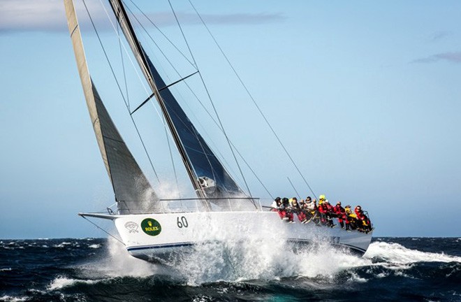
Loki battling the waves off Tasman Island - 2012 Rolex Sydney Hobart Rolex/Daniel Forster
http://www.regattanews.com
The long predicted southerly change for the 2013 Rolex Sydney Hobart race is expected to hit all areas around 11.00pm Saturday night.
Until then the fleet will experience hard running conditions of 20-30kts from the north, slowly switching to the NW, before quickly clocking around to a south westerly direction.
With a race finish time of just after midnight, expected race winner, Wild Oats XI will be right on the edge of the change and may miss it. The other supermaxis will be crossing Storm Bay on the final approach to Hobart and will cop the first of the expected 30kts plus headwinds.
Others like the 50fters will be reaching down the eastern side of Tasmania, having crossed Bass Strait with the assistance of the push from the strong northerly. They should be OK until rounding Tasman Island at the entrance to Storm Bay - and there they will cop a pasting from winds expected to average 30-40kts with gusts substantially above that strength.
From there on to the finish the boats will be beating into the teeth of the westerly gale, maybe turning the race into a big boat benefit on rating as the smaller boats at the end of the fleet struggle in the survival conditions.
The sea state may not be as extreme as would be expected in Bass Strait, due to the shelter afforded by the Tasmanian landmass, however seas and westerly swell is still expected to be significant particularly rounding the tip of Tasman Island.
Wind maps from Flinders Island and Bass Strait from 5.00pm Saturday through to Sunday morning - the key to the wind strength is the colour bar at the top of the Predictwind developed charts.
The key points to look at in this set of wind maps from Predictwind is the strong NE flow to the right, favouring those who have stayed out to sea, inshore the winds lighten and also swing north - a less favourable point of sailing. At 8.00pm we can see the wind swing north and start to lighten and swing NW in advance of the coming south westerly front and wind change. At 11.00pm the wind is well into the west, for those inshore. By 2.00am and 5.00am the breeze is increasing in strength and settling into a W-SW direction at a speed of 35-40kts average (add 15kts on top of that for gusts). The boats should be tight reaching out of Bass Strait and along the Tasmanian manian coast in these conditions.
Wind maps from Tasman Island and Storm Bay from 5.00pm Saturday through to Sunday morning - the key to the wind strength is the colour bar at the top of the Predictwind developed charts.
The points to look at in this set of maps which show the conditions likely to be experienced by those at the head of the fleet. Again we can see the stronng N - NE breeze pushing the lead yachts up the Tasmanian coast. At 8.00pm Saturday we can see the change moving across Storm Bay, earlier than it occurred in Flinders Island and Bass Strait. At 11.00pm the wind is swinging from the NW to the West and still a relatively moderate 15-20kts average with the usual factor of about 10kts for the gusts. From 2.00am to 8.00am on Sunday morning the wind cracks in, and settles into the West at 35kts plus average with gusts on top of that of 15kts. Seas are likely to be rough as the boats turn around Tasman Island. The boats will be on the wind after rounding Tasman Island before turning and heading for the finish line in Hobart.
If you want to link to this article then please use this URL: www.sail-world.com/117934