Hurricane Jose - Everything we know
by Weather.com on 13 Sep 2017
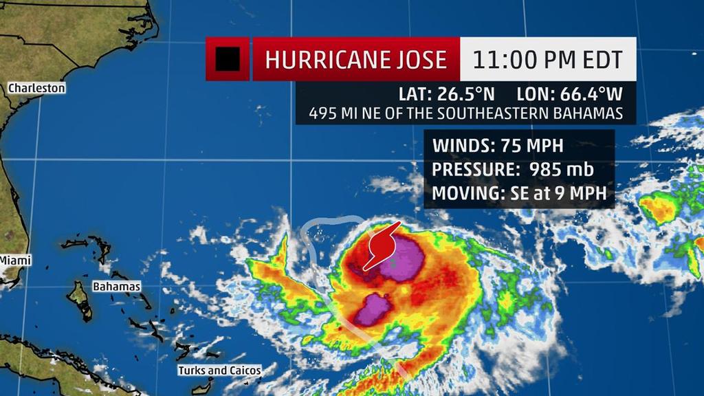
Jose Current Storm Info - The highest cloud tops, corresponding to the most vigorous convection, are shown in the brightest red colors. Clustering, deep convection around the center is a sign of a healthy tropical cyclone. The Weather Channel
Hurricane Jose is making a looping path in the western Atlantic Ocean this week, and it's now unlikely Jose will ever become a threat to the U.S. East Coast or the Bahamas. Jose is currently located about 495 miles northeast of the southeastern Bahamas and is moving southeast.
(More:
Hurricane Central)
Northerly wind shear has disrupted the inner-core convection of Jose, leaving its appearance rather disheveled in
microwave imagery from Tuesday morning.
This wind shear may persist for another couple days, and upwelling from Jose's slow motion may further weaken it to a tropical storm. Jose may then see a brief lull in wind shear, followed by increased southwesterly wind shear later this week and this weekend. All these factors should keep a relative lid on Jose's intensity the next five days.
Jose will complete a clockwise loop between Bermuda, the Bahamas and Puerto Rico by Thursday, then begin a northward track this weekend. How far west Jose gets before eventually curling north, then northeast, is the key question regarding potential impact for the Bahamas this weekend and the U.S. East Coast next week.
At this time, the large majority of forecast guidance shows Jose curling north, then northeast sufficiently to the east of both the Bahamas and the U.S. East Coast to avoid direct impacts. But that's not a certainty this far out in time. All interests in the Bahamas and along the U.S. East Coast from the Carolinas northward should monitor future forecasts of Jose, in case they change.
Full details here. Keep an eye on weather for updates in the days ahead for the latest details on Jose.
If you want to link to this article then please use this URL: www.sail-world.com/157211