Tropical Cyclone Pam – Latest update 8pm Sunday 15 March
by Arno Dyason on 15 Mar 2015
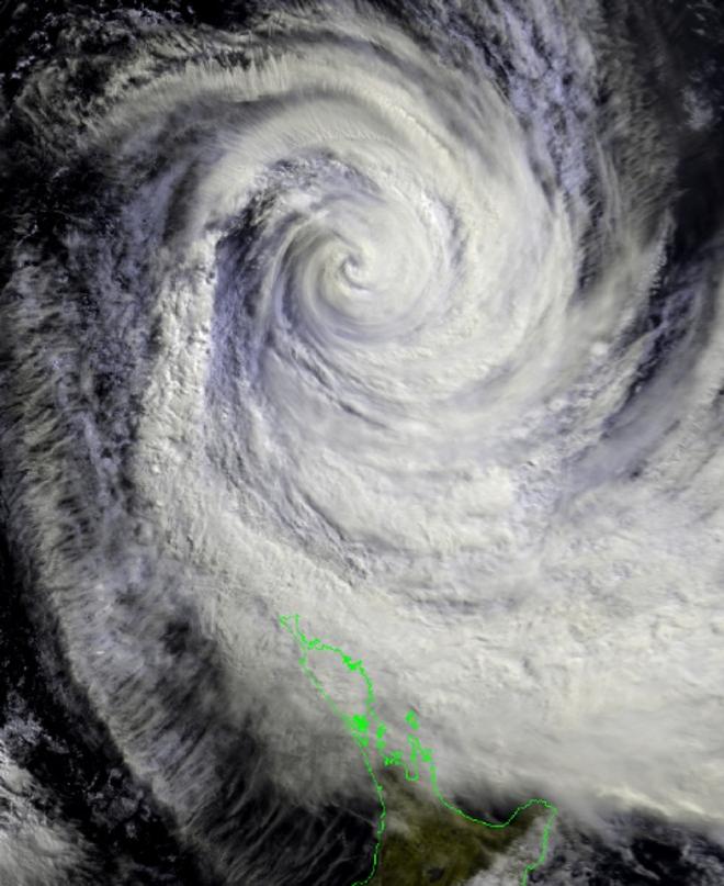
TC Pam to the north of New Zealand at 11am this morning - Tropical Cyclone Pam MetService
Currently cyclone Pam is situated 450km to the north of the New Zealand coastline and still tracking southeast at 55m/h. It is expected to lie about 150km east of East Cape (northern Gisborne) by midday Monday, then move away from the New Zealand coastline towards Chatham Island.
Strong southeast winds and rain are expected over much of the North Island tonight and Monday, along with extremely large seas about the east coast.
Wind gusts of 160 km/h or more are possible about the eastern Bay of Plenty and northern parts of Gisborne. Winds of this strength are likely to cause damage to trees and powerlines and could lift roofs and make for hazardous driving conditions. A burst of heavy rain accompanies these winds, with 180-220 mm possible about the Gisborne ranges.
Visit website for the latest severe weather warnings and watches issued by MetService for more information.
The image above shows the total combined waves (sea and swell) generated by cyclone Pam, which are expected to rise to 7-8m around the northern New Zealand coastline and even up to 9m around the northern Gisborne coast.
For any further information go to website
If you want to link to this article then please use this URL: www.sail-world.com/132471