Weather - the long and short of it in the South Pacific
by John Martin, Island Cruising Association on 8 Jun 2014
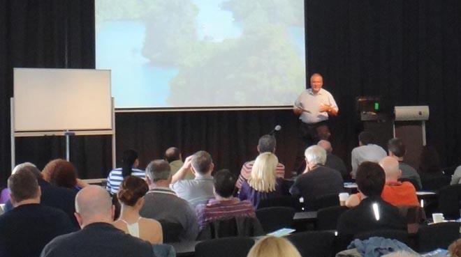
Island Cruising Association seminar SW
Island Cruising Association has for many years been operating successful rallies between New Zealand and the South Pacific and has recently enlarged its operations to include Australia and Indonesia. Choosing just the right weather to make that first crossing successful has always been key, and here rally organiser John Martin discusses this all-important feature of cruising
Weather - it’s the one thing, after making sure the boat and crew are properly prepared, that can make the difference between a pleasant trip and one perhaps no so pleasant. Let’s face it no one in their right mind goes in search of bad weather for an ocean passage and good weather routing can help you avoid the bad stuff, well most of the time.
Weather guru Bob McDavitt explains weather as a mix of pattern and chaos. If we have a look at the timing for getting the fleet off to the tropics this year in early May it was definitely a case of more chaos than pattern.
Typical May Weather.
Typically in May, leaving for the South Pacific Islands of Tonga, Fiji, Vanuatu and New Caledonia, you’d expect to see the usual migration of weather systems, low following high following low, in a procession from west to east. As winter starts to take hold the centres of the high pressure system tend further North (the STR or Sub tropical ridge) and the rate at which they migrate through accelerates. May is usually a great time to leave as winter is not yet in full swing, the high pressure centres or STR is only just starting to drift North and their rate of migration still gives a 7 – 9 day cycle between systems. With the centre pressures still well south the pressure gradient where the highs meet the sub-tropical low is still weak. As the STR moves north the gradient steepens and the trades start to reinforce.
That’s the pattern but this year we also got to see quite a lot of chaos in the mix.
During the summer months we have the cyclone season. To put it simply cyclones are intense tropical depressions and are born from convection and have a symmetrical warm central core that characterizes such systems. Convection is of course warm air rising and this is powered by the temperature of the sea. Autumn usually sees a cooling of the sea temperature’s in the tropics and therefore less convection. Not so this year, which saw severe cyclones as late as tropical cyclone Ita in mid to late-April and a string of tropical depressions forming over Vanuatu and Fiji through into the second week in May. It was these low pressure cells that made predicting the weather difficult and their spectre keeping the fleet safely ensconced in Opua.
From a predictive point of view, highs and lows in their natural progression are reasonably easy to predict and an accurately forecast out as far as ten days in not uncommon. The problem with tropical depressions is their unpredictability and the sensitivity of the various weather forecasting models to predict them. Some lean on the conservative side and some look like they’re predicting Armageddon in a weeks’ time only to get more realistic as the time frame gets closer. While these systems may be born out of convection in the tropics they can deepen quickly when mixed with cold air as they travel south. When cold air meets warm air, the warm air is pushed upwards out of the way. If the upper winds remove the rising air faster than the lower winds can replace it, then the surface pressure in the immediate area falls rapidly causing a destructive low pressure system.
Human nature of course being what it is has a tendency when reviewing these forecasts to lean towards the forecast that best suits our needs, whether it be right or wrong, so it’s important to choose just one provider for your weather, we use the Predict Wind model. It’s not uncommon when you get a group of cruisers together, each advocating a different model, to have total confusion, better known as analysis paralysis.
So what caused this chaos?
The World Meteorological Organization now says that a recent weakening of trade winds has significantly warmed the sub-surface waters of the central Pacific. This warm anomaly is now rising to the surface and causing these areas of convection. This warming effect is also having an effect on the Souther Osilation Index or SOI. The Southern Oscillation Index SOI sums up the weather patterns over the South Pacific as one number. It is based on the standardized difference in the barometer readings between Tahiti and Darwin and is the precursor to the weather effects known as La Nina and El Nino.
The current prediction by the weather experts is when this stored energy reaches the surface we will have an El Nino episode which could manifest within the next month or two. The amount of extra heat currently stored in the tropical Pacific has been measured to be on a par with the amount that gave us the last big El Nino in 1997/8.
So what is an El Nino / La Nina event?
The experts say we are heading for an EL NINO event and Bob McDavitt sums up nicely the difference between the two events.
In an El Nino the Sea temperatures of the Equatorial Eastern Pacific (the STEEP for short) are WARMER than normal. This is caused by the trade winds being LESS intense than normal-- so that the sun-heated sea is NOT physically blown off into the western Pacific as much as is normal.
The extra heat causes more evaporation and thus more cloud over the Peru end of the Pacific and all the weather zones are drawn closer to the equator. The SPCZ is sifted further north and thus further east. The subtropical ridge , the rail track for the High systems-- in winter gets to go between 20 and 30S ,rather than 25 to 35S
The disturbed westerlies of the roaring 40s get to go as far north as 35S maybe 30S in winter , so the whole of New Zealand gets frequent cold fronts and SW winds.
A LA NINA episode occurs when STEEP is cooler than normal , making eastern end of Pacific dry (and Australian end wet) All the weather zones mentioned above are pushed further than normal AWAY FROM the equator.
There is also the Pacific Decadal Oscillation , around a 20 years cycle. IT has been negative since 1997 and encouraging La Nina's . It is likely to turn positive by 2017 and then encourage El Nino episodes for the next twenty years or so.
So what does this mean for the average cruiser?
If past El Nino events are anything to go by then stronger dry easterly trades for the SW Pacific tropic areas and more westerly, wet conditions for New Zealand. With the STR moving north the region of accelerated trades will also move north with it placing the squeeze zone between the high pressure systems and the inter tropical low between 12 and 18S instead of the recent 18 to 25S.
This should mean an easier passage south from the tropics at the end of this season and a dryer than usual winter in the tropics.
That means the water maker will get more use, you’ll need to put on more sun screen and you’ll need a couple of extra cans of diesel for the passage south in October or November.
For more information about the Island Cruising Association, to join one of their rallies, or even to attend one of their highly informational cruising seminars, click here.
If you want to link to this article then please use this URL: www.sail-world.com/123042