Something to ponder - Is your GPS system 100% safe?
by Simon Jinks, RYA/Sail-World Cruising on 16 Jun 2013
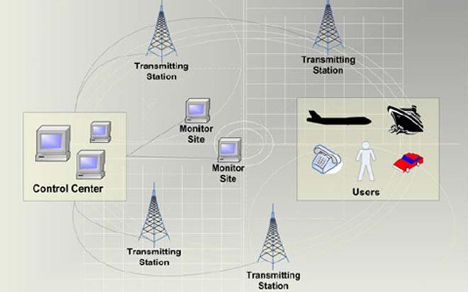
eLoran - A possible solution to nervousness about lost or jammed GPS signal. SW
How safe is your GPS system? Even if you have multiple redundancies on board your sailing boat, what happens if the signal actually fails? How could that happen and what about the alternatives to GPS now being rolled out? Would they be a solution? - or if not, now that fewer and fewer sailors are carrying complete paper charts, what IS the solution?
Recently, the RYA's Simon Jinks wrote about just this issue:
Within a decade, our skies could be full of new GNSS (Global Navigation Satellite Systems), such as Europe‘s Galileo, Russia’s Glosnass, China’s Compass and India’s GINS. They will all be vying for space above our heads feeding the world’s addiction for a PNT(position, navigation and timing) fix.
Each new GNSS requires approximately 20-30 satellites in order to operate, so there may be well over 140 in orbit.
If one satellite or an entire system goes down, there will be plenty of others to take its place.
The current thought is to make the systems interoperable so a chipset within the on-board GNSS receiver will compute all the accessible data from the different systems and use the best one for your fix.
Spurious signals:
However, there may be a problem. The signals used by GNSS systems are very weak and are vulnerable to interference. The frequency range of the new GNSS systems are all similar and with more satellites operating, comes the possibility of more interference or noise leading to a loss of signal tracking with the resulting inability to compute a reliable fix.
GNSS is also susceptible to satellite failure, antennae failure, and natural solar events and to the illegal use of jamming equipment or accidental jamming from TV antenna amplifiers or stray emissions.
An internet search for ‘GPS jammers’ produces a vast amount of GNSS jamming equipment commonly used by vehicle thieves and disgruntled employees unwilling to have their works van tracked by their boss. These are becoming more of a concern to the maritime world.
Two separate trials were carried out Flamborough Head and Newcastle-Upon-Tyne , on the NE coast by the GLAs (General Lighthouse Authorities) to establish the effect of GPS jamming on maritime operations. Trial vessels were monitored as they transited the affected area and the results showed that positions were out by up to 22km and speed over ground rose to over 100 knots in cases.
Even more worrying was the fact that under very low signal strength jamming, the positions computed by the on-board GPS would show a slight error to the vessels position which may go unnoticed but could be significant to the safety of the vessel.
A possible solution:
The vulnerability of GNSS systems has led Britain's General Lighthouse Authorities (GLA) to get involved in the development and testing of a stand-alone navigational system that could provide a back-up if GNSS fails. This back-up is eLoran (enhanced Loran), a low frequency, and terrestrial system, based on a much modernised and updated Loran technology.
LORAN C (Long Range Navigation) has been around for years and was the one of the primary navigational systems accompanying Decca before GPS. It uses low frequency radio waves from land based radio transmitters and depending on the system used, gives positional accuracy to about 100 – 400m.
eLoran offers positional accuracy of 10m (95%) and work is being performed on the development of a Loran chipset to allow a receiver to compute a position based on eLoran or GNSS.
The high power, low frequency signal of eLoran is harder to jam and thus could compliment GNSS; this is why the GLAs are championing eLoran to provide a cost effective back-up to GNSS.
Accuracy:
The main difference between Loran C and eLoran is the inclusion of a Loran Data Channel on the signal that allows timing and corrective information to be sent to the receiver, increasing accuracy. The system has been shown to work providing accurate timing and positioning information to coastal and medium distance offshore applications.
Recent testing has produced very positive results for eLoran. The successful implementation is dependent on governments agreeing to upgrade their Loran C infrastructure to eLoran and commit to long term funding.
The way ahead for marine navigation and safety is electronic and GNSS offers a global solution, but there needs to be an effective back-up system to catch GNSS when it falls.
This offers a very good reason for the prudent sailor to continue to carry paper charts against the unthinkable occurrence of an inaccurate, jammed or completely disappeared PNT system on your sailing boat.
If you want to link to this article then please use this URL: www.sail-world.com/108170