Book Review- Tasmanian Anchorage Guide - new edition released
by Doug Cuming/Sail-World Cruising on 3 Mar 2013
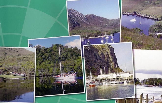
Tasmanian Anchorage Guide scenes SW
Summer and early autumn, the perfect time to be sailing Tasmania, so it's good news that the Royal Yacht Club of Tasmania have released the fifth edition of their Tasmanian Anchorage Guide, now with coloured maps of all their recommended anchorages around Tasmania.
It is an essential guide to cruising one of the most beautiful and secluded cruising areas in Australia. It was originally prepared in 1992 for participants in the Van Diemen’s Land Circumnavigation cruise, with the 2013 event now underway following the highly successful Wooden Boat Festival in Hobart.
The Tasmanian Anchorage Guide provides significant coverage of the most of the anchorages in Tasmania in the following sections:
**Hobart to Freycinet: the Derwent River, Storm Bay, the Freycinet Peninsula up to Coles bay;
**The East and North East Coasts: Bicheno to the Tamar, including St Helens;
**The Furneaux Group including Flinders Island, Cape Barren Island to the Kent Group;
**The North Coast including the Tamar River and King Island;
**The West Coast including Macquarie Harbour and Port Davey.
**The D’Entrecasteux Channel including the Huon river Recherche Bay and Bruny Island
A detailed description of each anchorage is provided highlighting:
how to approach,
relevant lights and leads,
where to anchor,
what wind and sea conditions it is suitable for,
whether it is affected by swell and,
what facilities might exist.
Some of the anchorages are covered with a high level of detail, especially the secluded but extensive west coast anchorages of Macquarie Harbour and Port Davey, including information on bushwalks and points of interest. The Bathurst Harbour coverage includes the passage to Melaleuca Lagoon with soundings shown on a 1956 hand-drawn chart from A.C.N. Wyatt off the ketch Saona.
An introductory section covers the history of the Guide, relevant marine charts and publications, biosecurity issues, passages distances and coastal radio stations.
As a comparison to other Tasmanian cruising guides, the Tasmanian Anchorage Guide has more written detail compared to the Cruising Tasmania guide by Brettingham-Moore, but the latter provides more detailed maps of the anchorages, including soundings not covered by the charts, especially evident for Bass Strait Island anchorages. It also has a section on the history of Tasmania.
The Cruising Yacht Club of Tasmania’s Cruising Southern Tasmania provides excellent coverage of the Derwent River to New Norfolk, D’Entrecasteaux Channel, Huon River and Bruny Island and would the preferred choice for these areas.
The Tasmanian Anchorage Guide has 175 pages which are spiral bound enabling the book to be used practically and take a bit of rough treatment. It is available at Boat Books Australia’s Sydney or Melbourne stores or via the Web (www.boatbooks-aust.com.au) for $69.95.
If you want to link to this article then please use this URL: www.sail-world.com/107046