Please select your home edition
Edition
PredictWind - Wave Routing 728x90 TOP


New models boost Weather Routing accuracy

by PredictWind 26 Jun 2023 02:53 PDT
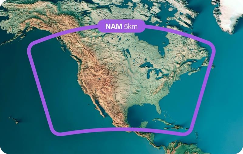
NAM Map © PredictWind

PredictWind has a mission to provide the most accurate weather data on Earth. We are excited to announce three additions to our list of high-resolution Weather Routing models. As the leading source of trusted weather data and tools, PredictWind now delivers the UKMO 2km and Arome 1.25km weather models in Europe, and the NAM 5km model covers North America as part of our Weather Routing and Departure Planning tools.

High-resolution modeling provides more accurate and detailed forecasts in shorter timeframes. This means that using them in weather routing and departure planning can result in more accurate routes, especially in coastal situations. For racing sailors, this can mean winning race data. However, high-resolution models have limited forecast length and coverage area, which can be problematic for longer routes. To address this, we pair the high-resolution models with global models to provide full routes over any timeframe and geographic area.

The pairing of different resolution models is nothing new for PredictWind. We have been doing this with the high-res PWG and PWE 1km > 8km > 50km models for a decade. Now, the UKMO global 15km model will interface with the UKMO 2km model, the Arome 1.25km model will pair with the 9km ECMWF in Europe, and the NAM 5km model will pair with the 25km GFS in North America. This complex operation is seamlessly performed within the PredictWind weather routing engine adding no complexity for the user.

The process that PredictWind uses to calculate the Weather Routing and Departure Planning allows large high-resolution files to be used in every routing calculation. The routes are calculated in the PredictWind cloud, utilizing the highest available resolution and the most recently updated forecasts and ocean data. Since the heavy processing is done in the cloud, the transfer to the vessel requires a very small file size. This makes unparalleled data available on any connection type.

The new high-resolution models are available in the weather routing now. Maps are only available in the PredictWind App and Forecast website, GRIBs will be coming to the Offshore App shortly.

Related Articles

PredictWind unveils the new PredictCurrent app
The world's most advanced tidal current app This specialized app grants access to incredibly detailed current data, offering an optimized interface for enhanced usability with a quick-view dashboard showing wind, current, waves and tide height all in one place. Posted on 4 May
The Importance of Weather Forecasting
Understanding forecast weather conditions can be crucial to your survival PredictWind is a world-leading weather forecasting tool for boaters. Weather conditions such as storms, high winds, swells and currents can cause havoc for those on the water. Understanding forecast weather conditions can be crucial to your survival. Posted on 1 Apr
Safe routing through the wind, waves, and current
Weather Routing does so much more than get you from A to B In seconds, know exactly what conditions are ahead, how comfortable the route will be, and how to safely and efficiently avoid bad weather, rough seas and shallow water with the world's most advanced routing algorithm. Posted on 19 Mar
Predictwind announce Over the Horizon AIS
Predictwind have released an all new Over the Horizon AIS (OHA) feature on the DataHub Predictwind, the world leading weather information, forecasting and routing service have released an all new Over the Horizon AIS (OHA) feature on the DataHub. Users can view AIS data out to 300nm, directly on your chartplotter and nav apps. Posted on 19 Feb
PredictCurrent: High-res tidal currents model
This groundbreaking solution empowers users to navigate local waters around the globe PredictWind, the leader in maritime weather technology, has announced the launch of PredictCurrent, the world's most comprehensive, high-resolution tidal currents model. Posted on 5 Dec 2023
PredictWind unveils PredictCurrent
The world's most comprehensive, high-resolution tidal currents model PredictWind, the leader in maritime weather technology, announces the launch of PredictCurrent, the world's most comprehensive, high-resolution tidal currents model. Posted on 1 Dec 2023
Predict Wind - Passage planning with PW tools
Having accurate and reliable weather information is paramount to maritime navigation In the world of maritime navigation, having accurate and reliable weather information is paramount to ensure the safety of voyages, whether coastal or transoceanic. Posted on 2 Nov 2023
Free Atlantic Crossing webinar
Part one covered the basics of weather and communications Last week we kicked off our two part Webinar series covering everything you need to know for a successful Atlantic crossing. Posted on 16 Oct 2023
Innovative Powerboat Weather Routing Tool
PredictWind's latest innovation transforms coastal and offshore passages PredictWind, the leading provider of marine weather forecasts and tools, proudly announces the launch of its pioneering weather routing feature specifically designed for Powerboats. Posted on 28 Sep 2023
PredictWind: Perfect complement to your Starlink
Aiming to reshape the way mariners use their communications devices We at PredictWind are thrilled to announce our latest initiative that aims to reshape the way mariners use their communications devices. Posted on 18 Sep 2023
PredictWind - Routing 728x90 BOTTOMPredictWind - Offshore App 728x90 BOTTOMPredictWind - GO! exec 728x90 BOTTOM