Garmin launches GPSMAP® 620- suitable for land or sea
by Garmin on 21 Apr 2009
For street or sea use, the new GPSmap 620 is versatile and durable. MIAA
Garmin Ltd, the global leader in satellite navigation, launches the GPSMAP 620 – an ultra portable and rugged touchscreen navigator which accepts optional street, topographic and marine charts.
“Blending the best aspects of our popular portable marine units with the intuitive user interface of our automotive flagship line of nüvi® navigators, the GPSMAP 620 is the perfect tool in the boat and on the road,” said Dan Bartel, Garmin’s vice president of worldwide sales.
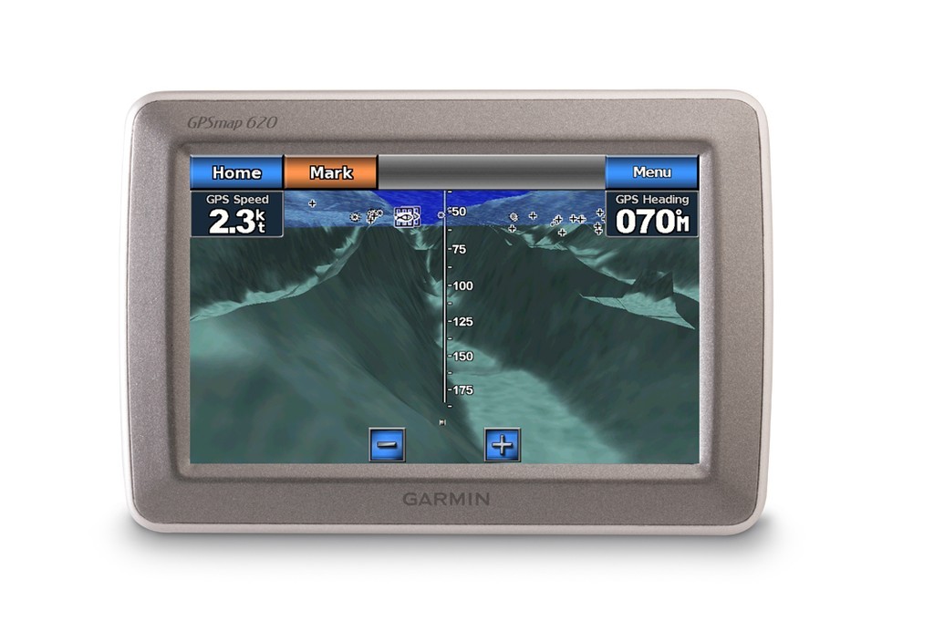
Portable and powerful, the GPSMAP 620 series features a high-sensitivity GPS receiver and boasts an intuitive, waterproof (IPX7) super-bright 5.2” WVGA touchscreen display (800 x 480 pixels) that reacts as users tap or drag through intuitive menus and options.
The GPSMAP 620 comes with a worldwide basemap and accepts optional comprehensive street maps, topographic maps and BlueChart®g2™ charts. When placed in its included marine mount and being used with the optional BlueChart g2 cartography, these new portables will automatically start up in marine mode, presenting chart features such as shaded depth contours, port plans, wrecks, restricted areas and more.
With optional BlueChart g2 Vision™ technology, the GPSMAP 620 provides a true 3-D “mariner’s eye view,” for a navigation perspective above the waterline, and a “fish eye view” for an underwater 3D bathymetric contour perspective. Mariners will also benefit from the auto guidance technology the g2 Vision data card enables that suggests the best navigational route.
In addition, photo references give detail aerial views of points of interest (POI) such as ports, marinas, waterways and landmarks.
When boaters are ready to pack up and hit the road, the GPSMAP 620 effortlessly snaps off its marine mount and, when placed in the automotive mount, quickly transitions into a robust automotive navigator.
When use with optional City Navigator or TOPO Australia, on the road, this device gives voice-prompted turn-by-turn directions, advising you to “Turn right on Main Street.” In planning a route, users can search for a local bait shop or the best resorts around town and the GPSMAP will lead the way. With the GPSMAP 620, users can also create custom POIs and set up proximity alerts for the ultimate in driver awareness.
The GPSMAP 620 has a Recommended Retail Price of $1200.00 and will be available in stores from the 20 April 2009.
More at www.garmin.com
If you want to link to this article then please use this URL: www.sail-world.com/55984