Sea Level Rise Maps spell risk for coastal properties
by Jeni Bone on 21 Dec 2010
Insurers are taking a good look at global warming, but at the moment, focusing their efforts on annual weather conditions. SW
Sydney, Melbourne, Brisbane, Perth and the Gold Coast, as well as many communities on Australia’s vast river networks, are in peril from inevitable sea level rises – shown in graphic detail on Maps released this week by the Department of Climate Change and Energy Efficiency (DCCEE).
85% of Australians cling to the coast line of this vast island. If global warming is a reality, it won’t be just Tuvalu and Tokelau in the Pacific (5m above sea level at their highest points) that are underwater within 90 years.
But the imminent threat, greater than the 0.5m sea level rise by the year 2100, is the potential for falling property values and rising insurance premiums on coastal properties, such as marinas, yacht clubs, resorts and residences.
Insurance companies and reinsurers globally are paying attention to the scientific studies and analysing their predicted impact on the coast and river regions.
Mark Crockford, National Marketing Manager at Nautilus Marine says there is plenty of work being done behind the scenes, but owners of coastal assets need not panic. 'We aren’t looking at 100 year forecasts at the moment. We’re mainly concerned about studying weather patterns and annual trends at this stage. Anything above the 26th parallel in cyclone areas is our focus at the moment.'
Nautilus Marine insures 'anything that touches a pleasure craft', Mark explains. 'That includes the boat itself, marinas, berths, boat builders, materials and any business involved in pleasure craft.'
Mark says the insurance industry is definitely 'sitting up and taking notice' of forecasts for the next century. 'There will be changes ahead, not immediately, but in the next few years following the analysis of this scientific data.'
Then, he predicts, premiums and policies will change in accordance to the perceived risks.
Terry Towell, Managing Director at Allianz (of which Club Marine is a subsidiary), says that by itself, a rise in the sea level resulting from climate change will not have a significant impact on the price and availability of property insurance, either for marine-related property, such as marinas, or commercial or residential property more generally.
'This is because, traditionally, insurance cover under property policies generally excludes damage caused by ‘action of the sea’, which may be exacerbated by sea level rise.'
He continues: 'Property damage caused by other perils may increase over time as a result of the impact of climate change on extreme weather events, for example, more frequent and/or severe storms. To the extent that such trends increase the overall cost of insurance claims, insurance premiums will be impacted over time and, in extreme circumstances, the availability of insurance in particularly vulnerable areas may be affected.'
Terry says that Allianz, both in Australia and internationally through its parent company, 'actively participates in industry discussions and initiatives, and the public policy debate more generally, on the impact of climate change on insurance'.
As for the value of properties and any sudden mass exodus by coastal property owners - generally priced at a premium and referred to as 'prestige' - property guru, Andrew Winter, himself a resident of Queensland's Gold Coast, says he has not heard a word uttered about declining values or owners wishing to get out.
'These new maps provide no new information. We have known about flooding and rising sea levels since the 40s. In Queensland, flooding has always occurred and coastal property owners have always known the risks. We are seeing surges, king tides and heavy rain all over Australia at the moment. Hedges Avenue (at Mermaid Beach on the Gold Coast) was under water in the 50s.
'Developers and builders have been taking precautions for the past decade,' says Winter, and they have been accommodating for high tides and cyclonic conditions and building accordingly with materials and plans that suit.
'They have been making house blocks higher and roads higher, basements dedicated to laundries and garages with good drainage.'
Winter's advice? 'If you are buying land or building in a risky area, take the conditions in to consideration.'
There is no doubt, business and government will need to work together to formulate a response to this aspect of the impact of global warming.
If scientists heralding continued global warming are correct, sea levels will continue to rise globally, severely impacting every country, coastal or land-locked.
According to CSIRO researchers involved in the 'Sea Level Rise' think tank, headed by Dr John Church and Dr Neil White, in excess of 150 million people live within 1 metre of high tide level, and 250 million within 5 metres of high tide. There are billions of dollars invested in coastal infrastructure immediately adjacent to the coast. Many of the world's mega cities (home to many millions of people) are on the coast.
The consequences, outlined in this week’s maps from the DCCEE are chilling.
The series of charts, devised in partnership with the Co-operative Research Centre for Spatial Information, use the highest resolution elevation data currently available.
They show the grave impact on low-lying areas in Melbourne, Sydney, the Hunter and Central Coast NSW, Perth and South East Queensland.
The inundation maps identify coastal areas that are vulnerable to one of three sea level rise scenarios for the period leading up to the year 2100. The scenarios are low sea-level rise (0.5m), which is likely to be unavoidable; medium sea-level rise (0.8m); and high sea-level rise (1.1m), which is the high-end risk identified in the fourth assessment report of the Intergovernmental Panel on Climate Change.
Sea level change, says the CSIRO, is the result of an increase in greenhouse gases and a warming ocean resulting in increase of ocean volume through thermal expansion. 'There has also been addition of water from glacier and ice sheets and changes in storage of water on or in the land (such as retention of water in man-made dams and extraction of water from aquifers). These together result in changes in sea level.'
CSIRO forecasting shows that Global Mean Sea Level, which increased by 195mm between 1870 and 2004, is continuing to rise at a fairly steady rate of just over 3mm per year – which is causing flooding problems in low-lying island states like Tuvalu, Kiribati and the Maldives and will soon be felt more seriously in places such as Gippsland, Victoria and the Gulf coast of the US, where large-scale land subsidence causes a higher rate of rise.
The CSIRO experts point out that although Australia is rising at about 0.3-0.4mm/year due to Glacial Isostatic Adjustment (GIA), we are still likely to feel the effects.
The maps show projected inundation for sea-level rises by 2100 of 0.5 metres, which is likely to be unavoidable, 0.8 metres and 1.1 metres.
In NSW, up to 62,400 homes were estimated to be under threat from inundation, mainly in the local government areas of Lake Macquarie, Gosford Wyong, Wollongong, Shoalhaven and Rockdale.
For Sydney, suburbs most at risk of inundation include Caringbah, Kurnell, Cromer and Manly Vale.
And it’s not just the coast that will feel the rises, with flooding predicted along the Parramatta River, threatening homes and infrastructure around Homebush Bay, Newington and Silverwater.
Also on the maps as low-lying areas are Cooks River, Arncliffe and Marrickville as well as Sydney Airport.
Around the country, other coastal cities and river regions will be affected, with maps showing significant risk in Melbourne, Brisbane, the Gold Coast and Perth.
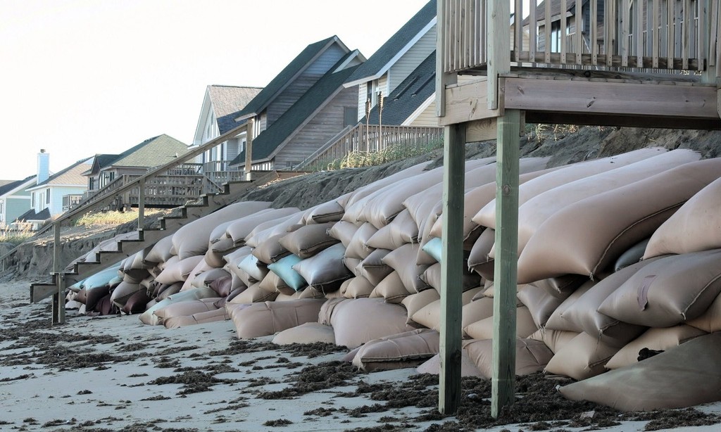
Sea-level rise contributes to coastal erosion and inundation of low-lying coastal regions, particularly during extreme sea level events – king tides, cyclonic conditions, monsoons, torrential rain.
It also leads to saltwater intrusion into aquifers, deltas and estuaries, known as salinity. 'These changes impact on coastal ecosystems, water resources, and human settlements and activities. Regions at most risk include heavily populated deltaic regions, small islands (especially coral atolls), and sandy coasts backed by major coastal developments,' explains Dr Church.
The Minister for Climate Change and Energy Efficiency, Greg Combet, said coastal areas were a 'priority for adaptation action'.
'The maps provide useful initial information to decision-makers to prepare for potential risks from rising sea levels in coastal areas,' he said, adding that governments and Councils would need to prepare for the impacts of climate change on new and existing developments.
Legal experts warn that developers, property owners, Councils and coastal authorities will have new responsibilities under each state’s Sea Level Rise Policies. The NSW Government has just released its Sea Level Rise policy and tabled the Coastal Protection and Other Legislation Amendment Bill 2010. Other states had similar benchmark sea level rise predictions, though they are not necessarily in line with each other.
These documents work on the assumption that sea levels will rise by 40cm by 2050 and 90cm by 2100.
Referring to the NSW Sea Level Rise Policy, Clayton Utz special counsel, Claire Smith said that any new development needs to consider the likely increases in sea level over the lifespan of that asset and undertake appropriate risk-based site planning, design and development control to minimise the likely impacts.
In NSW alone, the state government deems 200 existing houses at 15 'erosion hotspots' at risk from major storm events. Sea level rises would place even more at risk.
Under the Bill, developers and land owners may be liable for new coastal protection levies or rates. They would have some right to protect property and infrastructure from erosion, though coastal authorities would gain new powers to prevent or remove illegal works that may cause coastal erosion. The proposed Bill, if passed, will increase the maximum penalty for offences from $11,000 to $495,000 for corporations and $247,000 in other cases.
The maps are available at www.ozcoasts.org.au
More at http://www.cmar.csiro.au/sealevel/index.html www.environment.nsw.gov.au/resources/climatechange/09708sealevrisepolicy.pdf
If you want to link to this article then please use this URL: www.sail-world.com/78296