COGOW for passage planning - it's just been upgraded
by Lee Bruce on 29 Jan 2010

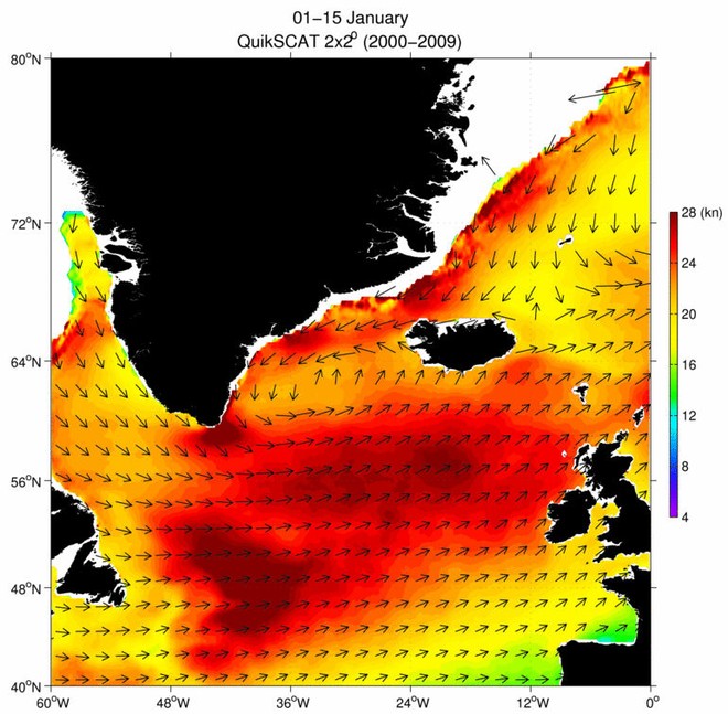
COGOW sample image SW
When passage planning, one needs all the help one can get to choose the right time to go, and the right winds to depart.
The good news is that the excellent Climatology of Global Ocean Winds (COGOW) website, which is of crucial assistance when planning a passage, has just been updated.
ALL the years of available date have been added to make the results more accurate, and the months have been broken in half, to show better the transition between seasons.
For all sailors planning a passage, the more information you have the better, and here Lee Bruce, of www.oceanmet.com!OceanMet (a division of Tactical Weather LLC) tells you why certain sites can so much improve your planning:
Traditional climatology records are based on decades of data, and can be useful as long as we understand the limitations. Because the data are averaged over long periods, we can lose a feel for the variations that may occur. Extreme events are masked, so we don’t know how bad it could be in a worst-case scenario.
The problem is compounded over vast ocean areas because—until recently—there has not been a reliable data collection process. Ship reports are sparse and tend to be clustered near traditional trade routes. Extreme events may go under-reported because the crew is busy dealing with the problem at hand, and does not have the opportunity to report conditions.
For several years now, a product has been available that uses sensors on a satellite to measure the wind over open ocean surfaces. The system (reading near real-time data collected by NASA/JPL's SeaWinds Scatterometer aboard the QuikSCAT satellite) scanned the oceans twice each day, as the satellite revolved around the earth from pole to pole. Due to the footprint of the sensor, there was a shifting data gap with each pass that is widest near the equator. But overall, the information gathered was very good, and a tremendous advantage over any previous data-gathering method. Unfortunately, the QuikSCAT platform failed late last year, and it looks like it is out for good. According to the web site (http://manati.orbit.nesdis.noaa.gov/quikscat/), it lasted seven years past its design life. The loss of the real time QS data doesn't affect the COGOW site--adding more data wouldn't significantly change the results.
There still is a source of real time satellite-measured winds at http://manati.orbit.nesdis.noaa.gov/ascat/, and from that site you can view even higher-resolution wind data--but with less coverage than the old QuikSCAT.
Oregon State University's site is the one that has just been upgraded. It now shows BI-monthly averages over all the years that these have been collected, and also presents a wind rose to show the wind distribution.
Cruising sailors should have this site bookmarked to aid in route planning. The maps are great, but they also need to review the wind roses for the real story.
http://numbat.coas.oregonstate.edu/cogow/index.html
The COGOW site has a link to a user manual that has good info--especially with regard to interpreting the wind roses. But the manual is a PDF that is 11MB, so you may want to wait until you have a broadband connection.
If you need professional assistance planning a more than usually difficult route, go to the www.oceanmet.com!Ocean_Met website, or you cannot do better than contact Lee at:
weather [at] oceanmet.com
If you want to link to this article then please use this URL: www.sail-world.com/65929