Forecasting at Sea - How good are you?
by Ken Batt on 11 Jan 2008
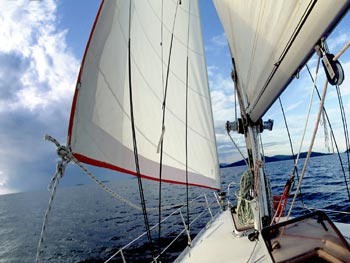
Reading the signs SW
How good are you at weather forecasting at sea? ''Looking out the window'' has long been a corny joke about what weather forecasters sometimes don't seem to do. However, when you are at sea, forecasting by ''looking out the window'' can be vital to a successful passage.
Because atmospheric motion is very complex, weather forecasting can be difficult at the best of times as there are many variables to be taken into account.
Forecasting is even more complicated at sea than compared to the land when one considers the relative lack of data available to the user. But take heart, there are plenty of things that we can be doing to help ourselves. Just read on…….
One way of filling the data void at sea, is for YOU to perform regular, say at least every three hours, observations. These observations should be logged and include the following;
- wind direction and speed, 10 minute average plus maximum gust (which can up to 40% more than the average);
- cloud type, especially if cloud(s) is/are high, middle or low level;
- temperature (air and sea);
- barometric pressure tendency; and
- sea and swell conditions.
By logging the above variables and noting any trends in conjunction with regular broadcast forecasts, should enable you to build up a picture of what is going on around you and in particular it is the observation of cloud, followed by the barometric pressure tendency that will generally give you an indication of any impending significant changes. It is these changes with which you are particularly concerned because you know what the weather is at the current time, and presumably comfortable with, but changes in both wind direction and speed for example, may affect your future cruise strategy.
You should become very familiar with the 10 main cloud types, namely, cirrus, cirrostratus, cirrocumulus (high-level clouds), altocumulus, altostratus (middle-level clouds), nimbostratus, stratocumulus, stratus, cumulus and cumulonimbus (low-level clouds). There are many good weather books and cloud charts around for you to buy or borrow that will help you here.
When you are happy with this aspect,( it takes time!!!!), then you can start to concentrate on cloud sequences or trends. It is the sequence or trend that is very important in forecasting. An example of a 'must know' cloud trend (outside of the tropics) is that associated with the passage of a cold front.
It goes like this, 20 to 30 hours before the arrival of the cold front, we will generally observe high-level clouds, 6 to 12 hours beforehand middle-level cloud will be observed and marking the leading edge of the front close to the surface will be our low-level clouds. We should remember that from the point of view of cloud and weather, each cold front will be different from one to the other, and that some fronts will be cloud-free.
The aneroid barometer is one of your main instruments at sea to sense these significant changes. ( In the tropics significant changes in pressure would generally only be associated with tropical lows or tropical cyclones). It is the tendency, rise or fall over a time interval, the rate of change of pressure, that we are really interested in as forecasters and not so much the instantaneous value. Clearly a large fall in pressure means that a decent blow should follow. But the hardest questions to answer are firstly, how strong? And secondly, how long for? Unfortunately there are no categorical rules. The following may help you though:
A change in pressure of 3 hPa in 3 hours should have the crew on alert. This should lead to at least stronger winds developing in some 6 to 12 hours or so, perhaps reaching gale-force.
A change of 6 hPa in 3 hours is very significant and gale force winds, at least, should result within the next 6 hours.
A change of 9 hPa in 3 hours will probably mean that winds should be very close to storm force, if not already, within the next 3 hours or so.
Larger pressure falls should mean even stronger winds within a shorter time interval.
The above could hold for rising pressure, especially in the area between a cold front and the eastern edge of an advancing high pressure system which has its centre to the west of you.
We have to remember that on a moving yacht the pressure tendency as calculated by you from the barometer is not for a fixed point. For example, a yacht planning at 20 kts in an easterly direction while an active cold front is moving in the same direction at 25kts. In this case the barometric tendency on the yacht may show only a small rate of pressure fall whereas a nearby island may show a large fall, thus indicating a vigorous system. In this case the yacht's barometric tendency may be providing slightly misleading information.
In other words, we might have to add 1 to 3 hPa to the pressure rise/fall if we are heading toward the weather feature and subtract the same amount if we are heading away from it. The amount that you either subtract or add will have to be fine-tuned by you for various weather situations and the latitude(s) that you operate.
------------------------------------------------------------------
We will now just concentrate on wind forecasting for a while. The basic weather forecast obtained via radio (log it or better still record it) will give both wind speed and direction. Firstly, we should know that the wind direction and speed mentioned in official Bureau forecasts, observations and warnings are for a height of 10 metres (33 feet) above the ocean or land surface and are 10-minute averages.
Secondly, we should be very aware that wind gusts are generally not mentioned at all in forecasts so we should add a gust factor which may be up to 40% more than the average. We should also know that the force of the wind on our sails increases with the square of the wind speed. For example, if we take 25 knots as a point of reference and say that it exerted a force of one unit on our sail. An increase in speed to 35 kt will exert twice that force and 50 kt will be four times as great. A good reason to reduce sail quickly!
When interpreting wind forecasts we also have to bear in mind that forecasts (coastal waters and high seas) are written for fairly large areas and YOU, the user, might have to fine-tune the forecast for your area of interest based on your knowledge of local effects.
These local variations are more likely to occur close to the coast (within 10 nm). However even in areas greater than 10 nm from the coast variations can still occur. Due to lack of observational data, experience suggests that over the oceans, alternating bands or areas of locally stronger and lighter winds can occur which the high seas or coastal waters forecasts tend to ignore at times. This is especially true of pure trade wind flow.
Gusty winds will occur in the area around a cold front, but some evidence suggests that when we have a tight pressure gradient (isobars close together on a weather chart), the wind arranges itself in corridors of stronger wind interspersed with areas of lighter winds and these stronger winds can be 20 knots or more higher in speed than the average wind speed. This situation is similar to waves at sea where we talk about significant wave heights, but nonetheless there can be some waves at least twice that height.
So in trying to predict or fine-tune the wind direction and speed from a weather forecast, or a weather map or better still, both, you should always bear in mind that the wind could be stronger or lighter than the forecast suggests.
We also find that the wind is generally stronger over warm water and less in speed over colder water. If we have warm air over cold water, we have what is called a stable air-sea interface (sailing layer) and hence a marked wind shear situation. This generally means more twist in our sails on port tack and less twist
If you want to link to this article then please use this URL: www.sail-world.com/40767