Rescued Sailor Knew of Inaccuracy of Charts
by Nancy Knudsen on 4 Aug 2007
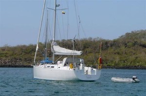
Lamachan in happier times SW
A British lone sailor who was rescued by the Australian Navy after hitting Elizabeth Reef north of Lord Howe Island, had already hit one reef earlier in the journey, and noted in his Blog that reefs were not always in their stated position according to charts.
Steve Landles is now recovering in Lord Howe after a nightmarish experience on his yacht Lamachan, which was taking water and threatening to break up on the reef while he waited for rescue. The yacht had hit the Elizabeth Reef, just south of the notorious Middleton Reef and north of Lord Howe Island, because of the inaccuracy of the nautical chart he was using.
While waiting for rescue, he twice attempted to reach a catamaran which was standing by for him. The first time, he tried to swim to the catamaran but had to turn back, and in the second he put out in his dinghy, which was swamped and again he managed to get back to his holed yacht.
Finally Landles was winched to safety by a helicopter launched from the Australian ship HMAS Ballarat. The ship had sailed from New South Wales to the treacherous Elizabeth Reef which has claimed many ships and is situated about 90 nautical miles north of Lord Howe Island and about 500 nm north east of Sydney.
There are two unrelated issues in this story that are interesting for sailors:
The first is the difficulty that any amateur crew can have in trying to come to the aid of a fellow sailing boat in trouble. Without proper rescue equipment and the experience to know how to use it, friendly and well meaning sailors may have little success in trying to effect a rescue. Sailors who set out to cross oceans should not take comfort from nearby yachts if their situation ever becomes serious, and be prepared to 'go it alone' if they strike trouble, while waiting for assistance from traditional sources.
The second issue is that anyone who has used nautical charts knows that, as most of the charting was done long before the days of the Global Positioning System, which today gives accuracy to within metres of your correct position, one can often not rely on the accuracy of charts. This was not as much of a problem before the days of electronic charting. This is because electronic charting can give the sailor a false sense of security as it purports – often incorrectly - to show the boat's position in relation to surrounding geographic features.
This problem of inaccuracy is particularly true of areas of the world which are not frequented by commercial shipping – The Red Sea and parts of the South Pacific are just two of these. Landles knew of this – in fact he wrote of it in his Blog:
Between Niue and Tonga lies an isolated reef in mid ocean - Beveridge reef - no height to see, just coral at water level. The Admiralty Pilot warns it may be 3 miles from its charted position. Problem is, the GPS tells you within meters where you are, but the chart is based on surveys done maybe 100 years ago by seafarers with sextants who thought within 3 miles was pretty good accuracy. And the seemingly up to date electronic charts loaded in our chart plotters are based on the old paper charts. So, the GPS gives sailors a false sense of security; they know precisely where they are, but they don't know to same precision where the hazards are. Wrecks on the reef confirm the problem.
Since we had good visibility we went quite close, relying on observation rather than the GPS. We were able to see the breakers over the atoll, and it was definitely not in its charted position. We can say that with some certainty. Looking at our trace on the chart plotter it showed us sailing over land!
Landles had also already had one - much less serious - experience of hitting a reef while sailing just weeks before in the Tuomotus, as he also describes in his blog:
Our South Pacific cruising guide says 'extensive reefs mean a grounding is probable at some time'. Our time was just off the abandoned village. The depth gauge doesn't help - the coral comes up too suddenly. We posted look outs at the front of the boat. You are supposed to be able to estimate the depth by looking at the colour of the coral. But even still, we 'kissed the coral'. You would hope to simply reverse off, but nothing is ever that easy. You suddenly seem surrounded by coral. But we were in luck. A local boat was in the area and came across to guide and pull. After that we retraced our path carefully and anchored in deep water.
Still, you would think that both these experiences, even if they were the only ones, would have alerted him to the dangers of relying on any chart when close to remote reefs.
Sometimes, I guess, you just can't win!
If you want to link to this article then please use this URL: www.sail-world.com/36338