Wily Weather - Secrets of Port Phillip Bay
by Ken Batt, Australian Bureau of Meteorology on 21 Apr 2006
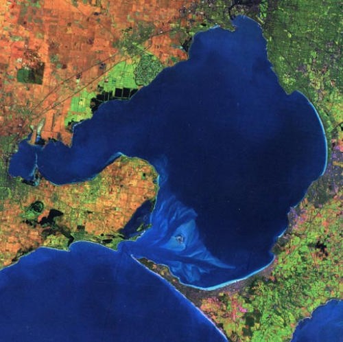
Port Phillip Bay Aerial Image SW
‘If there’s any weather you haven’t had today in Melbourne,’ the saying goes, ‘Wait ten minutes.’ Australian Weather Guru Extraordinaire Ken Batt puts it differently: ‘Port Phillip Bay,’ he says, ‘is a place that one can love one day and really hate the next.’ He goes on to cleverly analyse this tricky area. Read on and you will gain a real edge over the wiles of summer weather in ‘The Bay’.
The Bay is a large area (approximately 187,800 hectares) enclosed on all sides by land except for its southern parts where the Rip (Port Phillip Heads) opens into Bass Strait. The distance from the northern tip of the Bay to its southern tip is about 60km and its width (west to east) is about 65km.
Being situated where it is, Port Phillip Bay comes under the influence of the seasonal changes in weather that one would expect in the middle latitudes of the Southern Hemisphere. But even in the summer months a lot of people, including locals, will say that Victoria can generally experience those four seasons in one day. Having said this let’s now have a look at a fairly typical summer over Port Phillip Bay.
We can divide the weather situations that may affect The Bay during summer into essentially 5 different types. They are as follows:-
Type 1. Highs to the west. When a high pressure system remains over the Great Australian Bight or over northern Victoria, a west to south-westerly, sometimes southerly, airstream is maintained over the Bay. If a cold front moves over the state in this broad westerly stream then the surface winds will back from the west to the south-west with the passage of the system.
A sea breeze may reinforce any southerly flow in the above situation over the Bay. This is more noticeable over northern Port Phillip Bay, where a light southerly is reinforced by a fresh sea breeze in the afternoon and evening to produce choppy to rough conditions on the Bay.
Type 2. Highs to the south of Victoria: After the passage of a cold front, a high pressure system may quickly move eastwards and strengthen (not always) to the south of Tasmania. Under this regime a fresh east to southeasterly stream can be established over Bass Strait.
Port Phillip Bay winds can be complex during this situation, depending on the strength of the east to southeast stream. During the morning light to moderate winds are common over the northern end of the Bay while fresh to strong easterlies prevail in the south due to funneling through the Latrobe Valley. As the day progresses the winds over the northern end freshen as a result of the sea breeze component reinforcing the southeasterly wind. These winds tend to die out overnight though.
If the high is strong, the east to southeast winds can be fresh throughout the Bay all day and strong into the evening.
Type 3. Highs to the east of Victoria. When a high pressure system is located between Tasmania and New Zealand (very common during the summer months), it can become a dominant influence over the state. Winds are generally light to moderate north to north-easterly, with the chance of afternoon sea breezes on the Bay. The north to northeasters tend to be strongest during the mid to late morning and lightest during the afternoon.
If the position of the high is north of Bass Strait, then sea breezes would be dominant.
Type 4. Highs over Bass Strait. This situation would produce generally light winds over Victorian waters except where sea breezes reinforce the prevailing wind to produce a moderate to fresh wind about the east coast.
Type 5. Passage of a single cold front: The approach of a single cold front between highs is usually associated with a low to the south of Tasmania. Gale force winds may be associated with the passage of the front but these are generally only short-lived.
Sea Breeze
The sea breeze is a very important feature of the summer winds affecting The Bay.
There are two main features that influence the development of the sea breeze on Port Phillip.
The first is the fact that The Bay is an extensive, almost land-locked, body of water. This means that local heating of the land initially creates sea breezes all around its edges, blowing from the water to the land. Therefore the 'Bay Breeze' blows in different directions, depending on where you are around the Bay
The second feature is Bass Strait. This produces a stronger, longer-lasting sea breeze from the south which takes more time to develop than the more localised Bay breezes. The Bass Strait sea breeze (ocean sea breeze) interacts with, and finally dominates (but not always), the Bay breezes in the early afternoon through to early evening. The direction of the ocean sea breeze usually turns more into the southeast over the afternoon/early evening, especially over eastern parts.
Local Conditions
It is fairly well known amongst local yachties that often the northern half of the Bay experiences different conditions to the southern half. Most of these differences can be explained by the local topography and in the case of the southern half, the close proximity of Bass Strait.
Some examples of the effects of local topography on wind flows have been mentioned above. Others include the following:
In southern parts:
Winds tend to be funnelled between Mt Martha and Arthur’s Seat (near Dromana) in the southeast and near Point Henry on Corio Bay (Geelong) in the southwest.
The sea breeze on Corio Bay and on Port Phillip generally,can be relied upon to strengthen to a maximum at around 1500 hours in the afternoon.
The sea breeze will turn to be a southeaster during the late afternoon in eastern parts of the Bay, particularly between Mornington and Portsea.
In northern parts:
Wind tends to bend around the northern shores and it very often pays to 'hit' the shore to sail into a 'knock' and be lifted on the opposite tack.
In a typical sea breeze situation, depending on your race area, it normally pays to sail your starboard tack first and be 'lifted' on port heading west.
In a northerly, there can be more wind north of Ricketts Point (Beaumaris) and less in the south.
In the middle of the Bay:
Often in a developing wind situation, there is a 'No Persons Land' south of the Fawkner Beacon as the wind tends to build from the respective shores first. The Werribee shore is an area where there tends to be more 'pressure' more often than not. Keep those eyes open.
Another influence to bear in mind is that of tidal current. In particular those in the south near the Heads (the maximum tidal current here is about 8 knots) and in the north, adjacent to the Yarra River. The state of the tidal flow can have an influence on both the wind speed and direction and of course your leeway.
Shipping movements can have a very marked effect on racing fleets on the Bay. So always keep a lookout and give yourself sufficient time to manoeuvre away from any shipping.
Weather Problems
Some nasty weather problems at this time of the year may be: -
- Weather situations with strong surface pressure gradients (close isobars) may bring winds of 40 knots or more to The Bay.
- Wind squalls can occur on intense cold fronts.
- Gale force easterly winds can occur overnight on the Mornington Peninsula, extending north to Melbourne's southern suburbs, when a high pressure system passes to the south over Tasmania. In this situation there may be gales in Bass Strait, but the strength of the wind on the Peninsula may be due to a broad-scale gully wind effect.
- Thunderstorms can pose problems.
An east coast low, although rare at this time of the year, may create havoc over the Bay.
Summary
In summary we can say the following:
Whilst there is some local knowledge advantages, the weather on Port Phillip Bay is fairly predictable.
Cloud movements, particularly from the west, can indicate the app
If you want to link to this article then please use this URL: www.sail-world.com/23249