How AIS can make cruising safer and more enjoyable—World Cruising news
by David Schmidt, Sail-World Cruising Editor on 21 Feb 2016
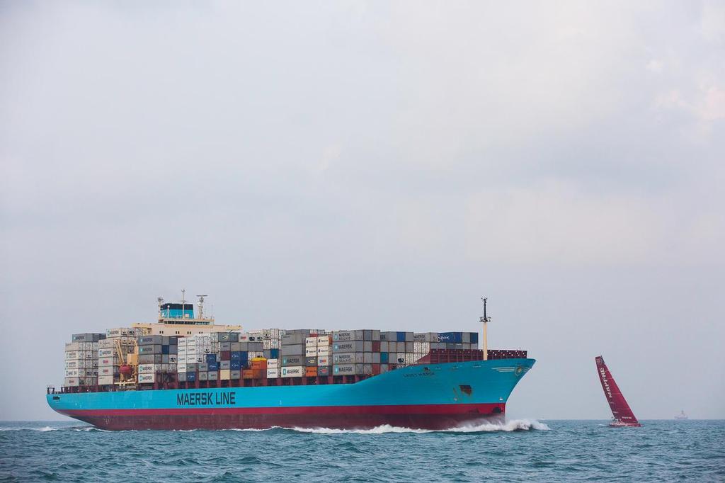
A Maersk Line cargo ship crosses close in front of Mapfre after leaving the Singapore Strait. Amory Ross / Team Alvimedica
When it comes to situational awareness, few pieces of technology are as powerful as the Automatic Identification System (AIS).
While radar is a navigational instrument (AIS is not), it is blindsided by landmasses (meaning it can't see what’s behind an island or peninsula), and it suffers attenuation issues in rain, snow and sleet. AIS signals, however, are sent via VHF frequencies, which allows AIS users to see approaching vessels behind low-slung landmasses, provided of course, that both vessels have properly installed and networked receivers/transceivers (more on this, later). Not surprisingly, AIS is quickly growing in popularity among international cruisers.
AIS comes in two basic forms: AIS Class A and AIS Class B. Class A transceivers are for large and/or commercial vessels, and they transmit their signal (which includes vessel name and type, position, course, speed and other navigational-status information) at 12 Watts every 2-10 seconds, while constantly listening for incoming AIS signals from other vessels. AIS Class B was designed for smaller vessels and for the recreational-marine market. Class B units function much like their big brother Class A units and transmit similar information, although they broadcast their signal at 2 Watts every (ballpark) 30 seconds.
While all Class A units are transceivers (namely, a device that can both transmit and receive signals), Class B users can purchase either a transceiver or a simple, listen-only receiver. This presents an interesting choice for sailors, as Class B transceivers are more expensive than Class B receivers, but they buy you a lot more situational awareness. For example, on a vessel with a Class B receiver, the crew needs to maintain an extra sharp lookout, both on the horizon and onscreen, as their own vessel isn’t broadcasting AIS information. In this scenario, a sailboat with only a Class B receiver can “see” a large commercial ship onscreen, but since they are not broadcasting their own AIS signal, the sailors need to assume that the large ship is blind to their presence.
Depending on the make and model of one’s AIS receiver/transceiver, users can set up alarms (either visual, auditory or both) if the AIS unit detects a collision course (or dangerous proximity) with a nearby AIS “target”. Better still, an AIS user can select any onscreen target and directly call the other vessel via its unique, pre-programmed Maritime Mobile Service Identity (MMSI) number. This provides a powerful way of directly communicating with other vessels.
[N.B., in order for AIS to function as described, each user must properly network their AIS to their GPS, and they must also obtain their MMSI number; this number then needs to be properly programmed into their AIS receiver/transceiver.]
In addition to vessel-to-vessel collision avoidance, AIS is now also being used to mark certain spots on electronic charts, either by broadcasting AIS signals to augment an existing charted buoy or aid (called a synthetic Aid to Navigation [AtoN]), or via a “virtual AtoN”, which electronically marks an area that’s not marked with a physical buoy or AtoN. As of this writing, synthetic and virtual AtoNs are being used in a variety of installations, but two of the most famous installations are in New Zealand, the first on a hill above the Ports of Auckland, the second on the South Island’s Doubtful Sound that protects cruise ships and private yachts from accidentally “encountering” the notorious Tarapunga Rock.
But given that AIS receivers and transceivers have the ability to receive information and display it on a chartplotter or an MFD, the world’s rescuing authorities are exploring new ways to increase everyone’s situational awareness using AIS technology.
Take, for example, the United States Coast Guard’s (USCG) ability to send out Application Specific Messages (ASMs) to mariners. ASMs can be used-for example-to cordon off specific zones or to shift shipping lanes to help protect whales or other marine life. Additionally, the USCG can use ASMs to augment their official Broadcasted Notices to Mariners, and the USCG and the U.S.-based National Oceanic and Atmospheric Administration plan to use ASMs to broadcast their Physical Oceanographic Real-Time System information, which will provide real-time weather observations and geospatial data to mariners.
So the next time you find yourself preparing to cruise down Australia’s east coast or ply the busy waters of the Strait of Malacca, make sure that you have a properly networked and configured AIS receiver or transceiver. You will be mighty happy with your investment when a ship appears to be bearing down on your position at 0300 hours.
[Sorry, this content could not be displayed]
If you want to link to this article then please use this URL: www.sail-world.com/142430