Ipad and sailing boats in Australia/NZ - What works and what doesn't
by Andrew Keays, Island Cruising Association on 7 Apr 2014
iPad SW
Electronic charts and/or paper charts for the cruising sailor is already a much discussed question, but how useful is an iPad or iPhone on your boat? What works and what doesn't? Here Andrew Keays of the Island Cruising Association discussess the magic of the iPad for your boat.
Sitting here today I wonder how we ever got on without the iPad. Looking back it’s only 6 years since the iPhone was introduced and 4 years for the first iPad.
I’ve always been an early adopter, though, so I have been with mobile devices and data, in its many incarnations, since the beginning – ever since I have been on the boat, really. I could see even back then that this was the way of the future.
As to the cost, yes mobile data is more expensive than land based but lately, and particularly with the advent of the 3G and now 4G iPads, mobile data is cheaper than ever before.
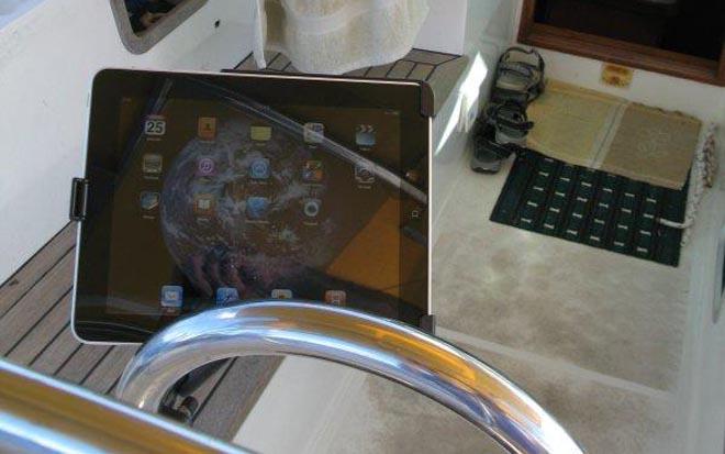
The iPad (and Air):
I queued up for my first iPad. It was the first day of the first iPad and I was in Adelaide selling my mum’s house. People were in a frenzy about this device that was going to revolutionize computing, and it has. Handheld and compact, really inexpensive apps, easy and fun to use – the iPad converts non-computer users to avid fans. Email, and web browsing are a snap. Even SMS. The device doubles as e-book reader. Even publishing and spreadsheet users can get by with just an iPad. More and more when I travel I don’t even bother with my MacBook Pro –that’s now only for serious professional things.
The iPad has been embraced by the marine industry and there are literally hundreds of great apps (applications, they used to be called programs on computers). Careful though, you need to buy the Wi-Fi and 3G or 4G models, because only they have an inbuilt GPS chip. There is much confusion about this, the wifi only units come with data assisted aGPS, where they use cell towers to give you a location. The 3G and 4G models are a touch more expensive but come with fully functioning GPS which works just fine offshore for the navigation apps. You don’t need to connect your iPad to cellular data if you don’t want to but you will need a wifi connection to download apps and of course the associated data.
You don’t need to buy new either. iPad are now in their fourth generation and are also now available in a mini version. Steer away from iPad 1, it’s slow and clunky, the iPad 3 is heavy and takes for ever to charge but the iPad 2 and the new iPad Air are great.
I have just upgraded my iPad 3 for a new iPad Air. The iPad 3 was the first with a high resolution 'Retina Screen'. The Air is physically smaller, although the screen is the same size, same resolution and lighter. Charging time is down too, but battery life remains the same. Every new iteration of the iPad doubles in processor speed, because that’s what technology does, but the extra speed won’t be particularly useful for most marine applications, more for graphics intensive video or pro audio apps.
And then of course there is the iPad mini. Any of the following apps will run on the mini. The older I get and the worse my eyesight becomes, the more I like the size of the iPad Air.
In my opinion, you should not be distracted by the plethora of non-iPad tablets out there. The primary advantage of Apple is the ecosystem they have built to support their devices. So if you have one device – say an iPhone, all your apps will work on your other devices (say your new iPad) it’s all shared through the 'Cloud' a virtual hard drive in cyber space. Watch out using the cloud though if you’re thinking of heading offshore data speeds are not what we’re used to in Australia and New Zealand. Watch out for the free apps too, there’s no free lunch and many of the features you want you may have to pay for via an in app purchase. I should note here that 'iPhone only' apps will run on the iPad, but if you want them to be iPad sized, you must zoom in on them, giving you pixelated images and poor use of the real estate on the iPad.
Navigation with Chart Plotters:
Before I start talking about chart plotters I really should reiterate the need for paper charts. If you do your planning on paper charts, checking your waypoints and routes carefully to ensure you are not going to come to grief on a reef or sandbar and then transfer your waypoints to the chart plotter (/app), these applications can take a great deal of work out of navigating. Don’t forget to actually look where you’re going as well though – I was recently introduced to the concept of 'chart plotter assisted groundings', so pay attention to the actual, not just the virtual!
Most plotters these days use vector charts instead of raster charts. Raster charts are high definition photos of actual paper charts. This means that all the info on a paper chart is there for all to see, at all magnifications. Vector charts, on the other hand, are written in layers, so, depending on the zoom level, different information appears. It is possible, therefore, to miss important information (like a reef!!) on a vector chart if you are not zoomed in enough. Applications do sometimes try to make sure you are at the appropriate zoom, but still nothing beats paper charts. Further, a chart spread on a chart table gives you an overview of the voyage like nothing else can.
Applications:
Navionics: Australia and NZ (A$51.99; Advanced Map Options, A$5.49; Nav Module, A$5.49)
I have used Navionics since they only made a version for the iPhone. The iPad HD version is much better and with recent add-ons, the Nav Module and Advanced Map Options are a great improvement to the functionality of the app. Last time I paid for a C-map chart for my Navman chart plotter it cost me around $500 for the Australian East coast.
At sixty something dollars the Navionics app is a steal, even if you consider the price of the iPad. The charts are accurate (wherever I have tested them) and beautiful high-resolution colour. As previously mentioned there is no requirement for a separate GPS antenna (if you’ve bought the right iPad).
The app is intuitive to use, with hand gestures or buttons to zoom in our out on the chart. One issue I have with Navionics is that you must zoom out to the supplied base chart to download complete chart data for the area you require. This is so the initial download is not prohibitive – fair enough I guess, just don’t forget to do it before you might be out of signal range with no access to wireless data.
The Nav module, too, is intuitive. Just point to the chart to place a waypoint – pick it up with your finger to move it or press the 'x' to delete it. Distance point-to-point appears automatically as does cumulative data. When travelling using a pre-planned route, the individual waypoint-to-waypoint distances are shown next to the cumulative distance WP0 to WPx. As you approach the next waypoint the focus automatically changes to the next leg of the journey. It would be nice to have a course up mode on the iPad version though.
iNavX (A$51.99 plus charts):
One alternative to Navionics is iNavX. If you don’t mind paying around twice as much as Navionics, for the app and the Australian charts and another $51.99 for the NZ, you get access to more charts and can use raster and/or vector charts. You buy your charts from https://www.x-traverse.com. X-Traverse is a website that allows you to save, retrieve and move data across iPhone and other mobile or desktop applications. Here you can buy charts for iNavx, back up or export your waypoints for use in Google Earth, and request GRIB information for weather forecasting. The Australian and the NZ charts are Navionics Gold vector charts or you can choose the Raster charts for New Zealand. The availability of raster charts, the course up option, the ability to export data and the ability to do GRIB wind forecast overlays might just be worth the extra money.
Transas iSailor (Free, plus charts):
Another cheap option is iSailor. The app is free, but the charts cost $25.99 for coastal chunks. Charts are Transas TX-97 Vector Charts split into smaller folios than either Navionics or iNavx. For example in Australia charts are: Torrres Strait to Sydney; Sydney to Perth (including Tasmania; and Perth to Torres Straits. New Zealand is a separate chart and uses the LINZ Raster charts, another A$25.99.
The app does have built in waypoints and navigation features and Course Up mode. I personally prefer the Navionics Gold charts, and the operation of Navionics, but I have not used iNavX (too expensive for me to just try it out).
Boat Beacon (A$12.99)
Moving away from chart plotters now another of my favourite iPad apps is Boat Beacon. This effectively gives you coastal AIS, without the need for a transponder. It will show you your position, speed and heading, and that of other boats in your vicinity.
Key features of this app include:
* Over-the-horizon collision avoidance (30 miles radius) using continuous Closest Point of Approach (CPA) calculations - highlights boats that are on a potential collision course and alerts you with an alarm.
* Continually transmits and receives position information and calculates and alarms CPA even when the app is running in the background.
* Shares your position with Global Internet AIS Systems and other Boat Beacon users in real time.
Live Map view with fully gimballed compass overlay rotates with you so you can look in the direction of the ships on the map to locate them.
* Boat-to-Boat Instant Messaging. Chat directly with other Boat Beacon users and your group in real time for free.
* Man Overboard tracking, SART Alarm, Anchor watch and Theft email alarms.
* Keep a watch and in touch with other boats in your flotilla when sailing in a group.
* Let Friends and Family see where you are and where you're headed to with the free Boat Watch app or on Boat Beacon and web-based AIS systems like Marine Traffic, which have free web viewers available. To be visible on Marine Traffic, you need to register your MMSI.
Boat Beacon:
Boat Beacon requires internet access to work. I have found Telstra coverage extends all the way up the coast from Sydney to the Whitsundays, even to most of the offshore islands.
AIS Ship data is provided by a world-wide network of AIS shore based stations and Boat Beacon says their coastal coverage is amongst the best in the industry and constantly improving. In order to maximise my coverage, on my last trip from Sydney to the Gold Coast I invested in a Telstra/Sierra 4G Air Card and went to Dick Smiths and picked up, for a couple of hundred dollars, a Sierra Hub, which, among other things, boosts the wi-fi signal 30%. It does run on 240volts though, so please consider this.
N.B. Boat Beacon is not an AIS transponder. You will not be visible to other ships on their VHF AIS systems.?
PredictWind (Free):
One of the top weather apps on the iPad is PredictWind. The app itself is free and there is a growing range of weather products, also available without subscription.
If you want the all singing all dancing Weather Routing and Passage Planning then there are a number of subscription packages. PredictWind also offer an email service for routing and weather updates while on passage via either SSB or Sat Phone email connections.
Compass Eye (A$5.49):
Compass Eye is a Professional Bearing Compass with real-time camera and map views, bearing markers and 8x zoom. This effectively replaces your hand-held bearing compass for coastal navigation.
Compass Eye uses the camera in your iPad or iPhone, with a compass overlay, to take a bearing on whatever object (adjusted automatically for true north if you choose), for transfer to a paper chart to obtain a fix on your position. You can choose to place the iPhone down horizontally to show the bearing on a chart.
You may also take and mark with a red line a bearing on a portside object (like a port lateral beacon), likewise an object on starboard (for example a sandbar, or a starboard beacon) with a green line and set a clearing bearing with a yellow line (see screenshot).
Data across Australia, New Zealand and the South Pacific:
As much as I would like to have different news, the fact is that, in Australia, Telstra has the best 4G network and the most continuous coverage of all the networks. Although Optus and Vodaphone are improving, and cheaper than Telstra, they are mostly confined to capital cities and major tourist hubs – not good enough for the coastal cruiser who needs to not lose data coverage.
In New Zealand It’s Telecom who offers the best coverage.
In the Pacific Islands - Tonga, Digicell has adequate coverage at a speed that is not a lot better than dialup. Fiji has Digicell and Vodafone, my pic would be Vodafone.
Vanuatu has Digicell and TVL both are good and coverage is over about 95% of the archipelago.
New Caledonia has only one provider, Mobilis, a division of Opt the French government telco. It’s not cheap but the coverage and speed are first world.
Your iPad can be used in any of these areas, simply buy a local sim when you arrive, slot it in and make one simple setting change, under Data settings replace the APN with the local providers details.
The iPad can also be used to connect other devices, such as laptops and other tablets via a personal hotspot, this can also be done via the Sierra hub previously mentioned.
About the Island Cruising Association:
The Island Cruising Association (ICA) offers an ever growing knowledge-base of cruising resources and information specific to Extended Coastal in New Zealand and Australia and Offshore, with an emphasis on the South West Pacific. They run a wide range of fun events, training, practical demonstrations, on the water preparation and back up to assist cruisers to get out there, and a growing range of rallies, just for cruising sailors. Of note is the NZ2OZ rally for International, New Zealand and Australian cruisers from Opua in NZ up to Vanuatu and across to Darwin in time to join Sail Indonesia out of Darwin. For more information go to the ICA website.
If you want to link to this article then please use this URL: www.sail-world.com/120847