Kinks and Contours
by Ben Knaggs on 22 Sep 2013
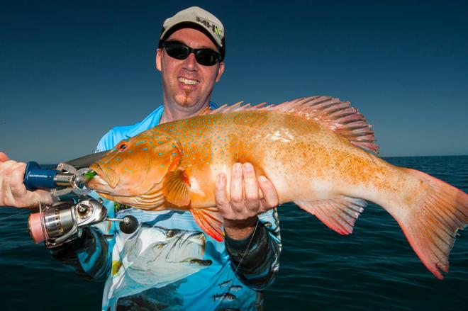
This nice big coral trout was pulled from a tiny blip of reef, found while sounding out a run of reef indicated on the chart. Ben Knaggs
Heading out on the open ocean to try to track down a few fish can at times be a daunting proposition. From our boat based viewpoint, there’s little to nothing to indicate where on this wide open playing field fish may be found. It all looks the same from above the water, and the sea hides its secrets well.
Of course, that’s not really the way things are in this modern world of ours. Sophisticated sonar, GPS and chart plotting technology enables us to gauge what lies beneath this watery blanket with amazing accuracy, turning the task of locating fish into a science rather than the lucky dip it once was.
More and more of us are spending the cash these days to trick our boats out with fish finding electronics that are becoming increasingly powerful and increasingly indispensible. Yet amazingly, only a small percentage of trailerboat anglers actually use this technology to its full potential. Could it be that these modern fish finding marvels are making us lazy fishermen?
A sounder is the most important piece of fishing equipment bar none on any trailerboat, so it’s stating the absolute obvious saying you should learn how to use and interpret it. But I’d like to point out another oft neglected source of information that many anglers seem to disregard, and that’s marine charting.
These days, most half decent GPS systems incorporate chart plotting capability, often with associated digital marine charting. Depending on the make and model of GPS/plotter, getting the most up to date, detailed charting available may cost you a little extra (usually supplied via separately sold SD cards), but this is well worth it, both for the sake of increased navigational safety and to help you find more fish.
If you can’t afford a modern GPS/chartplotter capable of digital charting, don’t despair, as there’s always the old school way of things with paper charts. These are available from most chandlery stores, and aren’t too expensive. The only downside is that you’ll likely need several to cover any decent fishing area.
The reason these detailed nautical charts are so valuable to an offshore angler is that with close inspection and a knowledge of the kind of ground that is likely to hold your target species, is possible to identify potential hot spots well before you travel anywhere near them. This is not only handy on your local waters, but also allows you a priceless head start in unfamiliar waters. In essence, with this info it’s possible to find fish quickly and easily in locations you’ve never even visited before!
So how is this done? Well, it’s simple really. Detailed nautical charts are laid out very similar to landform topographic maps. Major features like large reefs, islands, the continental shelf edge, jetties, breakwaters and so on will be clearly marked, and these in themselves can be worth fishing.
But it’s usually the smaller features like drop-offs, deeper holes and such that will be of most interest. These variations in the seafloor are denoted by depth contours (just like elevation contour lines on a topographic map), and these contours are well worth studying closely.
Sometimes a simple depth line itself, as shown by a contour line on your chart, is worth fishing. A good example would be when trolling for pelagic fish like marlin or sailfish, which may be hanging out along a certain depth range. Simply trolling along a depth contour can be all that’s required to find these fish.
When chasing bottom fish though, closer examination of the contour lines can reveal subtle fish holding seafloor formations that would otherwise take an age to find. Areas where contour lines pinch in very close together to indicate rapid changes in depth tell you of reef edges or drop-offs that are likely to be good spots to prospect.
Even better are areas of stacked contours that suddenly change direction. These are often referred to by anglers as ‘kinks’, and depending on their scale, could represent anything from canyons cutting into the edge of the continental shelf through to smaller gutters or reef runs. Either way they’re always worth checking out.
Contour lines marking well known features such as significant reefs can also help you to find those little known, rarely-if-ever-fished small blips of bottom structure out in the middle of otherwise flat, featureless seafloor. By studying the charts, it’s sometimes possible to notice a ‘run’ of reef that may continue on further than what’s marked on the chart. By following these runs and scouting around with your sounder you’ll often find small, fish filled spots that no one else knows about!
So keep an eye on those contours. Teamed up to a trained eye they’ll lead you to some sweet fishing.
If you want to link to this article then please use this URL: www.sail-world.com/114822