Superstorm hits east coast of Australia
by Jeni Bone on 28 Jan 2013
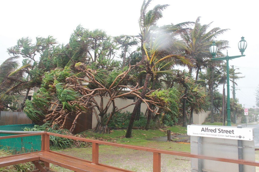
Mermaid Beach Gold Coast feels the impact of the superstorm Jeni Bone
First it was fires and record temperature heatwave, now the wet season has well and truly hit with former tropical cyclone Oswald continuing to wreak havoc along the Queensland coast, heading in to NSW.
After three days of pelting rain and winds up to 150km per hour, Rockhampton and Bundaberg have had the worst of the wild weather, while still experiencing flooding in some parts, and are now cleaning up.
On the Gold Coast, canals and waterways are swollen to record levels, choked with debris and wrecked jetties, even a trampoline, swirling about in strong currents.
This morning at 8am, close to high tide, a frothing ocean had reached the fences of the prestigious homes on Hedges Ave, Mermaid Beach. The beach paths are bubbling with sea foam and there is no sand visible, except that which has blown across the road.
The wind force prevented much access, and the car park was hazardous with sand and tree branches. Aussie flags were strewn across the roads, along with downed power lines, signage and the occasional fence paling. The odd local is attempting to clean up footpaths, or braving the conditions to walk bare foot to the corner shop for the morning newspaper and some milk.
Needless to say, the beaches are closed and local weather warnings put the gale force winds at 120km per hour. The rain is whipping across the streets and the few cars out have encountered traffic lights flashing amber, out altogether and tree trunks impeding road use in some places.
Queensland Premier Campbell Newman yesterday called for army helicopters to help in Bundaberg, where 300 homes and 100 businesses were expected to be inundated by floods overnight. Some homes had only just been rebuilt following devastating floods two years ago.
Police Commissioner Ian Stewart said officers had recovered the body of an elderly man at Burnett Heads. In Gympie, a 27-year-old man is missing after being swept away trying to cross the swollen Widgee Creek. A man and a woman he was with were rescued. There are also fears for a woman who drove into floodwaters at Pacific Haven near Maryborough.
Five small twisters tore roofs from houses, brought down powerlines and uprooted trees as they ripped into Bargara, Burnett Heads and Coonarr near Bundaberg, leaving some 20 people injured. Another tornado was reported at Mooloolaba.
More than 60,000 homes were without power across southeast Queensland late yesterday, with that figure expected to rise.
Northern NSW and Sydney have been put on alert as the huge storm cell, formerly tropical cyclone Oswald, surges south.
NSW is on red alert for flash flooding, damaging winds of up to 130km/h and huge seas similar to those that have caused chaos and millions of dollars in property damage across Queensland since the low pressure system made landfall on Cape York Peninsula six days ago.
SES spokesman Phil Campbell said the worst of the weather for Sydney was expected to arrive Monday between 5pm and midnight, bringing damaging winds of more than 100km/h, heavy seas and flash flooding.
Early today, the focus early has been on the north coast and northern rivers where the SES yesterday flew in 53 flood rescue specialists in readiness with more on standby in Sydney.
More information at www.bom.gov.au
If you want to link to this article then please use this URL: www.sail-world.com/106030