
Interview with Mike Sugden, Instrument Product Expert at Navico
by Mark Jardine 20 Dec 2017 14:00 PST
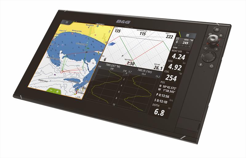
B&G Zeus3 © B&G
We spoke to Mike Sugden, Instrument Product Expert at Navico, about the latest B&G software version 4.5 which now includes full integration with PredictWind, and how advanced start line features - previously only available on the H5000 - are now standard on Zeus and Vulcan chart plotters.
The PredictWind features can now overlay forecasts for the next six hours on your charts as Mike explains, "We have the ability to connect to their servers automatically, download the latest high or low resolution weather GRIB files (which requires a PredictWind subscription) for a pre-defined area, or you can select a specific area manually, such as the whole Solent. These can also be automatically updated, checking the PredictWind servers to see if a newer version is available, making sure you always have the latest weather information in front of you."
The Vulcan chartplotter can connect to the internet by using a mobile phone as a wireless hotspot, any kind of mobile 'mifi' connection, or your marina wifi as and when needed.
One of the most innovative features is on routing, using cloud technology so that the processing is done off the boat on the PredictWind servers.
"We have the ability to talk to the PredictWind servers and services to say: I want to go from A to B, what is the best way to do that?" says Mike. "You put in your start point and end point, pass that information across the internet to PredictWind, they process the information their end and pass back to your Chartplotter a route which can then be displayed on screen using the four different weather models. You then have the option to follow a route, or decide which weather model looks the best to you.
"Taking that further, you can now do Departure Planning, for example: choosing that you want to leave when you can avoid strong winds or a big swell. We send that information to PredictWind and they return the best time for departure, based on your weather preferences."
With anything involving mobile data, the aim is to minimise the amount that is uploaded and downloaded, particularly when signal strength is weak, and B&G have thought about this as Mike explains, "We've implemented a way so that we have the minimum data transfer. PredictWind can pass us back a very small XML file once you've sent them your routing information. It's then processed internally and displayed on the screen."
Watching the system in action is the equivalent of Google Maps on your mobile phone for getting live traffic and routing information for a journey.
"It's bringing the technologies you see in different industries, like SatNav in cars, to the boater."
Another recent addition to the B&G chartplotter software is the start line information, giving a graphical and numerical representation of your final approach.
"We introduced the start line functionality with the release of H5000 a few years ago and have recently made that available to more of the mass market. The Zeus plotters can now do these calculations internally themselves, you no longer need the H5 processor. The plotter takes in all the boat's sensor information, such as wind speed and the current, and the pings* from the two ends of the line. It then works out which is the favoured end and will give you that information on the screen to help you get the best winning start possible. This is now available on the Zeus and Vulcan range of chartplotters."
Find out more at bandg.com/products/chartplotters
* Pings are obtained when you sail up to the Committee Boat end and the Pin End Mark or Boat and capture the GPS position of them both.