2015 Tropical Cruising – Passage Planning – From the SW Pacific to NZ
by John Martin, Principal, ICA on 3 Nov 2015
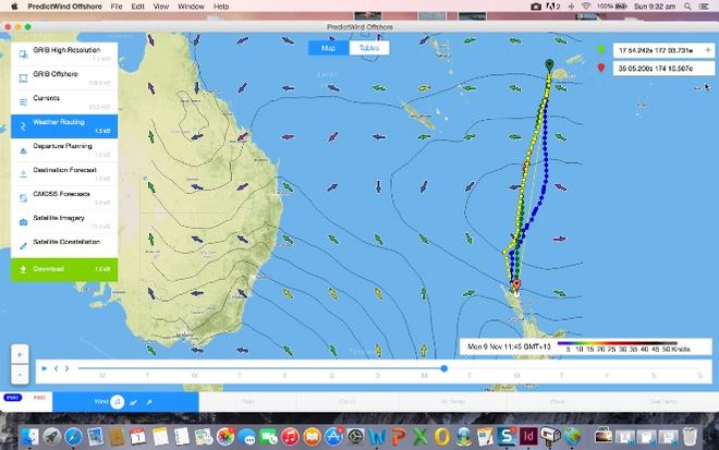
Passage Planning – From the SW Pacific to NZ - 2015 Tropical Cruising PredictWind
With the 2015 Tropical Cruising season coming to an end, many skippers are starting to look at the weather and what’s likely for the passage back to NZ. With today’s technology weather information is more readily available and the accuracy has improved immeasurably over the last ten years.
Weather routing packages like PredictWind’s Offshore App have also made daily routing while on passage a reality, taking the guess work out of the myriad information sources and displaying it in an easy to follow logical presentation of the data – I wouldn’t be without it. While it’s rapidly becoming unnecessary to have an in depth knowledge of weather and how it happens, good seamanship still dictates that while we may be able to get cutting edge information any time we want it we still need to have a basic understanding of the mechanics. Experience is also a wonderful thing – sometimes hard to get but easy to pass along. That’s where this article leads us.
There are a lot of myths surrounding the passage to New Zealand from the pacific islands. Most are the result of inexperience and lack of knowledge. I’ve done the trip personally now 42 times, soon to be 43 with our upcoming passage back from New Cal to Opua and only had one really bad experience, the very first trip. I decided after that first trip there had to be a better way so I started gathering some information.
The first thing I learned is don’t just pick a date and go. As it turned out boats that left just three days after we did, had a great trip. Weather is the governing factor when making this passage and your strategy will vary depending on your departure point. What doesn’t change is the nature of weather in this region. In the South West Pacific, the weather systems migrate from west to east – low follows high follows low in a never ending succession.
Coming across the Pacific from French Polynesia the trade winds blow south east and east with the occasional hiccup to the north and North West as a front or trough passes through. These troughs (unless you are being affected by the SPCZ) are usually associated with a low pressure passing to the south. The strength of the trades at the STR (sub tropical ridge) is dictated by the center pressure of the high pressures passing below and the latitude of its center. These are the generalities and I will give you some events to look out for that have an adverse influence on weather for a passage at the end of this article.
The effect a high pressure system has on the trades depends on two factors: the center pressure and the latitude of the center. A 1020 center pressure high will give 15 to 20 knot trades at the STR (where the high meets inter tropical low). As the center pressure increases so do the winds along its top edge. This area of wind, the STR, is the squash zone between the high pressure cell and the inter tropical low (which is the general area of low pressure either side of the equator). The latitude of this squash zone is dictated by the latitude of the center. For example, a high of 1030 with a center at 30 south will give significant winds (30 to 35 knots) from 15s to 25s with the wind decreasing the further south you travel. This same high, but centered over the middle of New Zealand, will have lower winds on its top edge (20 to 25knots) but spread over a larger belt. This high is also likely to have a larger area of little to no wind in its center. The high pressure centers tend to trend south as summer starts in NZ.
As the high pressure migrate east, the direction of the winds change. In the trade wind belt this variation is less pronounced but as you travel further south and move away from the influence of the STR the winds will tend to follow the rotation of the systems – both highs and lows. Highs rotating in an anticlockwise direction and lows, clockwise in the southern hemisphere.
As you travel further south the effect and intensity of the frontal bands associated with each low are magnified. The majority of low pressure cells during October and November migrate along under Australia and tend to pop north east in the Tasman, cross NZ and migrate to the east. All low pressure cells will have a frontal band originating well north of the system and rotating around the eastern side of the low, to its center. The closer to the low and the deeper the low’s center pressure will dictate how much punch it has. As the front moves through, the wind direction will change (as much as 90 deg) usually to the west and southwest with a disturbed flow. Rain is usually associated with a front with clearing showers behind. The strength of the wind in this area is determined by the pressure gradient. There will also be large variations in wind strength around rain cells.
So to summarise: the more intense the high the more wind you will get on its edge and the punch from a frontal band is greater the closer you get to the low. We also know the wind direction around a high is going to change as the high moves through and this is more pronounced the further south we are. We know further that as the high migrates through it will be followed by a low and its associated frontal band. In the weeks leading up to your passage we need to be looking at the speed that the systems are coming through. This will be between five and eight days typically. An eight-day cycle is easier to plan for, but short is OK too – you just take a different approach. Each year is a little different, this year, 2015, has seen a little more activity in the weather, with the systems coming through faster and cell activity both off the Southern Solomons. And off the east coast of Australia.
The high pressures have been moderate in their intensity and small in size. The center of the highs are still coming through north of NZ and should start to drift further south over October, easing the squash at the STR. Long range forecasting is predicting the center pressures to remain under 1030 so it will be interesting to see if the overall size of the systems gets bigger and the length of time between systems slows down. As for the lows, New Zealand has seen some deep low pressure systems over winter which has been wet and cold, not unusual. Indications and reports from those in NZ would indicate that spring is there and the weather is warming and the intensity of the weather systems is moderating.
So keep an eye on how the patterns develop in October and if you see a good weather pattern developing, take it. It’s better to arrive in NZ a little early. No problem there’s plenty to do there. OK, so now we need to consider where we are departing from.
Departing from Tonga
Tonga, the most eastern departure point has some advantages and some disadvantages. From here we are looking to leave in the top of a high pressure as the wind swings from south east towards the east. But being so far east means that once the wind is in the east the high pressure below is also well east, you will only have its influence for a short time.
The advantage is that you can use Minerva reefs as a stop off point if required and sit for the next window. From Minerva you are only 800 miles to NZ at an average of 5.5 knots or 130 miles per day this will take five to six days. Again it’s likely you won’t be able to do this in one weather system so you need to plan to have a frontal system somewhere along the way. This is going to have less punch if you are still north of 30 degrees south and with the wind direction changing to west and southwest behind the front the plan is to have put in enough westing so that you have cracked sheet for the last leg into NZ. We usually plan to aim for a spot directly north of North Cape, New Zealand’s most northerly point, at 30 south. This means quite a dog-leg from Tonga but is well worth the effort.
If things change as you head south, then the strategy can be changed. If you do decide that the high is moving slowly enough that you change your mind and head straight for NZ, make sure you can get there before the front comes through because those lovely NW winds you are enjoying will be right on the nose after the front passes. You are also likely to get an uncomfortable 18 hours as the front passes. It’s this decision to take the shortcut that causes most of the horror stories you will hear about.
So, in a nutshell, leaving Tonga, if you plan to stop at either North or South Minerva (North is a more secure anchorage) then wait until a high pressure (of around 1020 to 1025 center pressure) is giving an easterly flow. You should be two to three days to Minerva with the wind tending northerly when you get there. Because you will be looking to put some westing in, on the next leg, you can leave from there on the front of the next high when the wind is still in the southeast. Depending on your progress and how fast the high is moving will dictate your strategy as you progress south. Remember it’s better to take a front at 30 south even if you have to heave-to for a day and wait for it, better still use the time to get further west. Remember the old expression, west is best.
Departing from Fiji
Fiji on the other hand doesn’t have the advantage of a stop on the way and is the longest of the passages at 1260 miles, so you will need to leave a little earlier as the high starts to fill in; you are still looking for a high of around 1020 to 1025 center pressure. This will undoubtedly mean leaving Fiji in a little more wind than most would like but again you will want to get westing in from here too, so ease those sheets and go for it.
There is quite likely to be a squash zone along the coast of Viti Levu if you are leaving from the Lautoka area, this usually starts to drop 12 to 18 hours out. By leaving on the front of the system you are also more likely to run through the middle of the high as you progress south where winds will be light. Your strategy forward from here will be dictated by your use of the motor. If you have plenty of diesel and don’t mind the donkey clattering away put peddle to the metal and start heading for the same point as described above, 30 south directly north of North cape. If the high is slow and you will make it in before the next front then great, go for it.
You should get strengthening northerlies and northwesterly winds on the back of the high. Remember when it swings to NW the front is imminent. Regardless of how you think you are doing, don’t vary your approach too much. If you want to cut the corner and you feel you have the time, change your waypoint from the one above but make North Cape your next waypoint. The fronts have a tendency to jump up from down south very quickly, if you are hugging the Northland coast by then you will be in relatively protected waters.
Departing from Vanuatu and New Caledonia
Vanuatu and New Caledonia departures can be regarded as having the same strategy. Leaving from Vila, unless you wait for easterlies (when the high is directly below) you will be hard pressed to get past the Isle of Pines on port tack. From there you are looking to head for Norfolk Island. There is no need to be hard on here as the high will go through and give NE, North and then NW before the next system/front comes through. We have waited at Norfolk for the systems to pass and reached into NZ on west and SW winds, on the beam.
Tips and Tricks
Things to look out for:
If you are leaving later than early November keep a good lookout for anything with a closed isobar in the tropic region to your west, if you see one DON’T leave until it passes or disappears. As you get later the likelihood of low pressure cells forming in the Coral Sea (and particularly just south of New Cal) increases. If there is any chance of one of these lows forming on your passage don’t leave.
General strategies:
Look for a high of between 1020 and 1025, get west, take fronts north of 30 south, motor if your speed drops and don’t cut the corner unless you are sure of getting in before the next front. The only other advice I can give you is to pick just one source for your weather advice. If you allow yourself to get into groups that are discussing weather and they are using different sources you’re in trouble – we call this analysis paralysis. You may never leave! Get the right info.
We use and recommend PredictWind for weather information; there is a 20% discount link on the ICA home page for this service.
If you want to link to this article then please use this URL: www.sail-world.com/139902