Hurricane Jose to meander in the Atlantic this week
by Weather.com on 12 Sep 2017
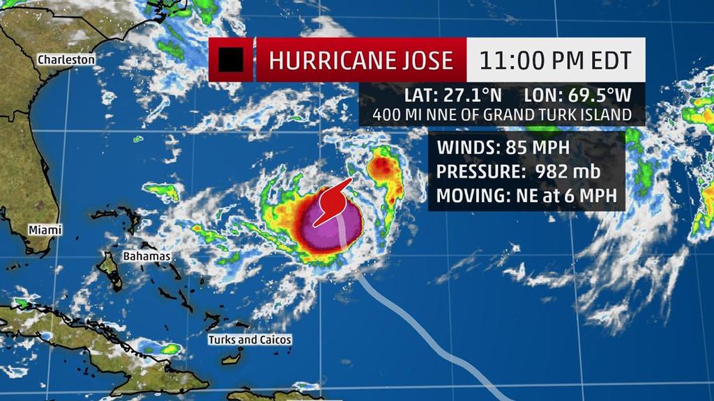
Jose Current Storm Info - The highest cloud tops, corresponding to the most vigorous convection, are shown in the brightest red colors. Clustering, deep convection around the center is a sign of a healthy tropical cyclone. The Weather Channel
Hurricane Jose will make a looping path in the western Atlantic Ocean this week, generating high surf and rip currents that will affect parts of the U.S. East Coast and the northeast Caribbean. Jose is currently located over 350 miles north-northeast of Grand Turk Island and is moving northward. Increased wind shear should slowly weaken Jose over the next couple days, but it should remain at hurricane strength.
(More:
Hurricane Central)
Through the week ahead, Jose will complete a clockwise loop between Bermuda, the Bahamas and Puerto Rico. The end of that looping path could result in Jose passing close to the eastern Bahamas this weekend. The future path of Jose after it makes its loop in the western Atlantic remains uncertain, but we will continue to monitor it for any potential U.S. impact next week. For now, swells generated by Jose and Irma will continue to affect the U.S. East Coast, leading to dangerous rip current conditions this week.
Keep an eye on weather for updates in the days ahead and for the latest details on Jose.
If you want to link to this article then please use this URL: www.sail-world.com/157179